
Nos autres sociétés à votre service
Bali Drone Production
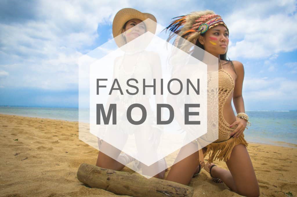
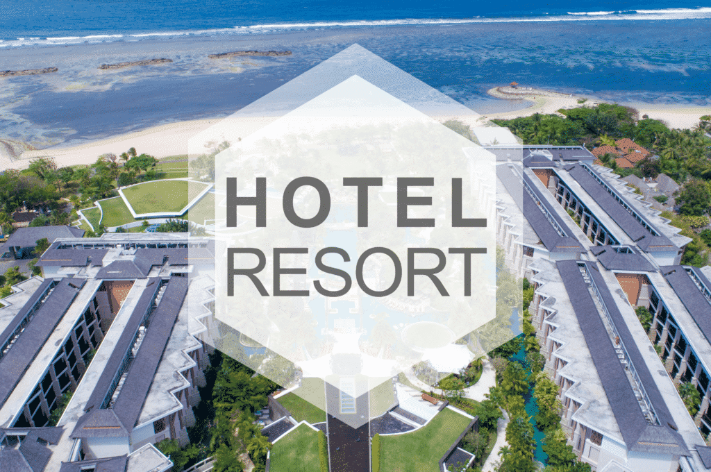
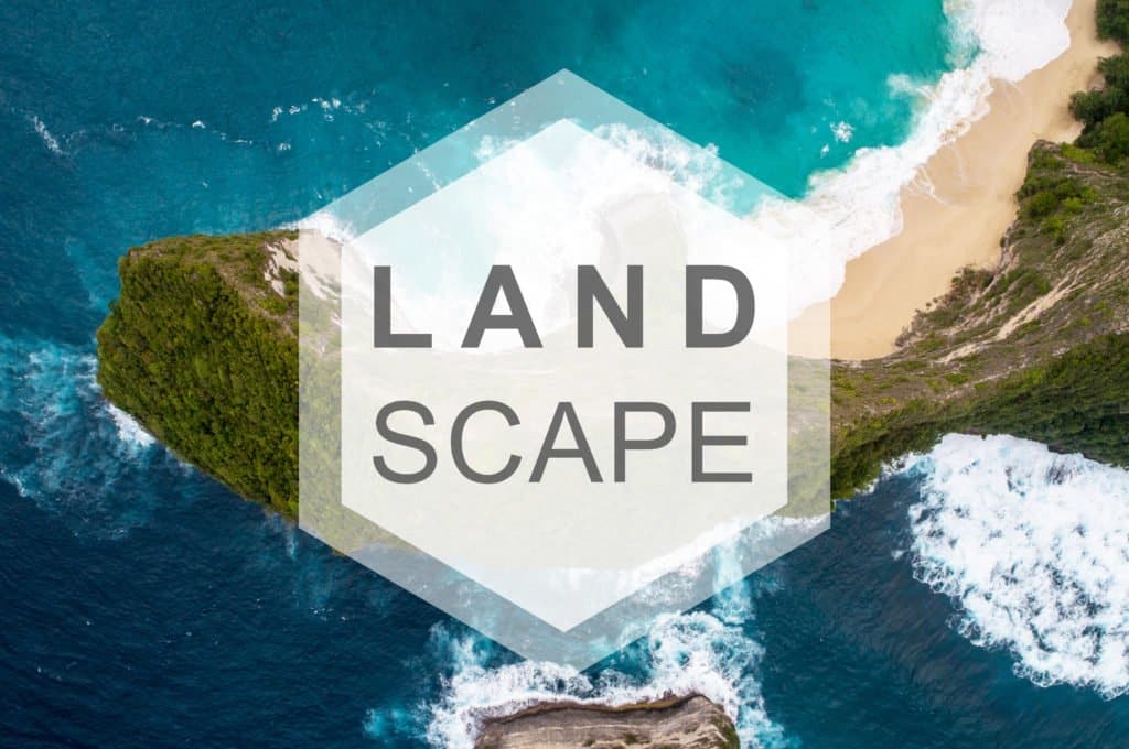
Bali Drone Production, is THE aerial imaging service not to be missed if you are going to Indonesia. This company specializes in aerial photography by drone, but they also operate on the ground with state-of-the-art equipment. Bali Drone Production offers different types of videography services depending on your type of project. Their main activities are 3D mapping by photogrammetry or Lidar for the industry, shooting for commercial advertising, Real Estate, Tourism, special events, fashion, marriage or shooting magnificent landscapes for cinema or other video needs. Bali Drone Production also offers an unmanned rental service, so you can rent a drone if you are already an amateur or professional pilot. They also offer a very good guide on how to transport your own equipment to Bali and what are the rules and laws to follow to avoid any problems once you are there. You can find this guide at this address: Official drone guide in Bali.
Advanced Technologies
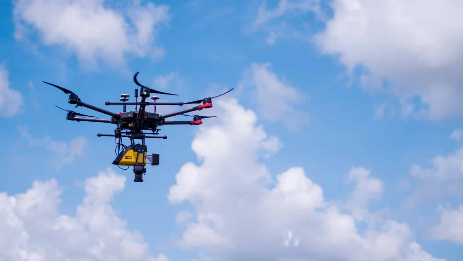
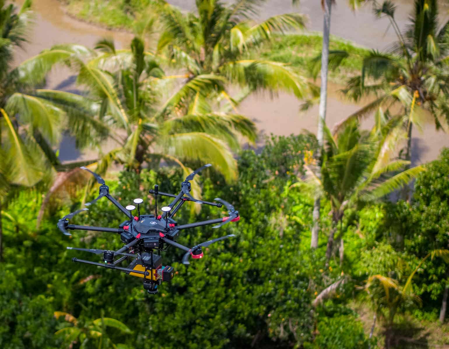
Their drones are equipped with the latest technologies: GPS and Glonass synchronization, Infra-red, positioning by sonar for indoor flight, batteries and intelligent flight system, 4K and 5.2K cameras… Thanks to their equipment, they provide a service of safe quality.
Professional Quality
All Bali Drone production cameras can record in 4K and also in 5.2K with our Inspire 2. These are ready to record in CinemaDNG or ProRes to provide you with a better quality image and more possibilities in post-production. The cameras are also stabilized on 3 axes, the result is just great: The videos are fluid and without shaking.
Pilot with official license
Hiring a pilot is fine, but hiring a drone pilot with an official license is better. Their pilots are approved by the Ministry of Transport, the DGAC and by the Indonesian Air Sports Federation. Bali drone production is working with the government to improve the safety of drone operations and establish a legal framework.
Services
3D MAPPING
3D shooting is now a big part of the activity in the drone pilot business. Drones can make 2D orthomosaic or 3D maps like point clouds or 3D mesh. 3D plans made by drones are useful for planning your next construction, doing a field study or monitoring the health of plants for agriculture. Drones, coupled with rendering calculation software, are capable of determining changes in elevation and generating contour lines. The files can be exported in different formats like DXF (autodesk), LAS, KMZ (integration into google heart possible) etc….
Commercial advertising
Do you need a video for your website or to broadcast on a TV channel? No problem, they have the equipment you need. You just need to explain what you need and they will make you the best possible video for your Company.


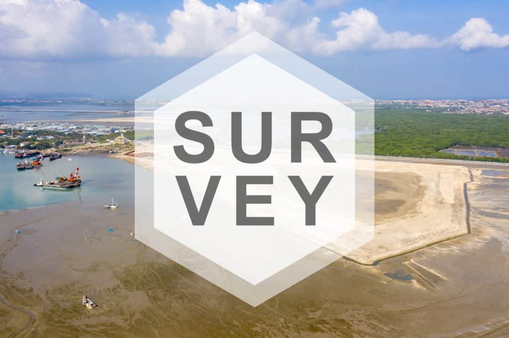

MSDI
MSDI is the High-tech mapping service of Bali Drone Production. This branch specializing in cartography offers topographic survey services with high-end equipment. MSDI uses a state-of-the-art laser scanner to carry out missions requiring a high level of precision. For more ordinary 3D plans, MSDI uses photogrammetry to generate maps that can be used in various fields such as: Development of real estate and architecture projects, civil engineering, Oil & gas energy, analysis of electrical networks and corridors, archeology, studies scientists, analysis and prevention of natural disasters (floods, earthquakes, etc.) Forest management and carbon footprint calculation. Lidar is also suitable for all the activities mentioned above and produces even more reliable data.
LiDAR mapping service
The Lidar is a high-frequency laser scanner that can take more than 100,000 readings per second. This “active” sensor measures the surrounding environment to the nearest centimeter and allows you to geo-locate information up to 1.3cm in accuracy. MSDI has one of the 14 lidar vx-15s in the world! We are proud to use the Yellowscan VX-15 with riegl minivux-1UAV sensor, one of the most renowned laser sensors in the world. The system is also equipped with an Applanix control unit to ensure precise geolocation. The Lidar has the great advantage of being able to see “through” the vegetation. “Through” is not really the exact term (because the technique is more complex), but it gives a better idea of the possible uses of this equipment. So we can precisely acquire the reliefs of the soil, even if it is covered with a drill. This mapping technology has long been reserved for aircraft because the equipment could not be carried by a drone, but with technological advances, it is now possible to carry out Lidar surveys by UAV / Drone.
Photogrammetry / 3D Mapping
Photogrammetry is the most widely used technique for generating 3D maps by drone. The drone crisscrosses a defined area with a recovery rate allowing the assembly of the multiple photos that are taken during the flight. Our software then takes care of calculating volume and relief using photos and geotagging. Photogrammetry is not just for topography, we can also use it to model buildings, structures, archaeological site, equipment and technical installations such as refineries, chimney, wind turbine, bridges, solar panels etc …
Do not hesitate to visit the MSDI website to learn more about the company and the services offered.